Blog
The Earth Observation Blog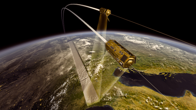
PAZ, the third musketeer
Flying in a kind of short zero-G trip, last week the PAZ satellite was set back to sleep inside its sarcophagus. Conveniently packed and looking gorgeous, it will now take a roadtrip to IABG facilities in Germany for satellite environmental test campaign. Next stop after that will be Baikonur, a Russian launch-site in the north of Kazakhstan, from where it will launch later next year onboard a Dnepr rocket.
The ones who are familiar with the German X-Band duetto TerraSAR-X and TanDEM-X will likely know what PAZ is all about. If you’re not, then as the other two PAZ is a Synthetic Aperture Radar satellite operating at X-Band, taking the most of the Earth as it orbits it around every 95 minutes. The three musketeers are rather similar: same satellite platform (a iconic hexagonal prism), and alike radar instrument. In 2012 Astrium (manufacturer of the three), Infoterra, and Hisdesat (PAZ owner) decided they will operate the three satellites with a constellation-like flight pattern once PAZ will be launched (the first two were launched in 2007 and 2010, respectively). This means that the three will image the Earth with the same orbit, but 120 degrees apart. The benefits of such scheme are a shorter revisit time for the final user demands, an increased data acquisition capabilities, and an improved service reliability, making the system robust and standardised.
Artist impression of PAZ satellite
Getting more into the details of PAZ itself, the satellite platform was built by Astrium Germany following the same design of TerraSAR-X and TanDEM-X. Nonetheless, the overall satellite prime contractor is Astrium CASA Espacio in Spain. As a result, when the platform was ready in Germany it was shipped to Madrid for SAR payload integration and test. Being PAZ a fully Spanish-funded satellite (as part of the PNOT – Spanish Earth Observation programme), most of the instrument parts were developed by several Spanish companies. That included the radar antenna elements and the transmission/reception modules, two of the key parts of the system, manufactured by Astrium CASA Espacio and Indra, respectively.
The applications of SAR data are really unlimited, and more and more creative scientists find new ways of improving our everyday lives. One of the uses of images in environmental monitoring are envisaged to forest protection, floods and landslides evaluation, and water quality assessment. The constellation approach allows for an even faster emergency response in case of natural or man-made disasters, providing fresh data to the experts for recognition of damages in infrastructures and populated areas. This results in taking the most appropriate and efficient coordination of rescue actions. Other applications include change detection and surface movements. Next figure is an example of the latter. The East African Rift is an area where two tectonic plates are moving apart and with the use of Interferometric SAR subtle surface variations (uplifts and subsides) may be monitored. The dormant volcano Mount Longonot in Ethiopia rose by 9 cm between 2004 and 2006. Tracking these changes allows to better understand and predict its behaviour.
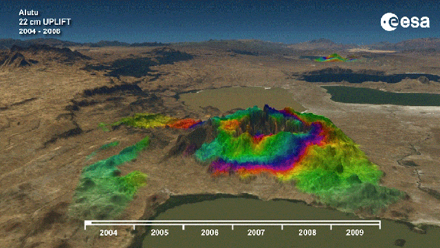
East African Rift tectonic plates movements near volcano Mount Longonot (courtesy of ESA)
Additionally, the fact that X-Band microwave signals are able to penetrate through the atmosphere makes it possible to image through clouds and different lighting situations, being attractive for taking images at all kinds of weather conditions, something considered a typical downside of optical instruments.
PAZ will be capable of taking images with different sizes and resolutions, according to each user needs. The standardisation within the constellation satellites makes it easier for the user to choose particular requirements for the acquisition. The available basic modes and resolutions are the following:
- Stripmap mode (SM)
- High resolution spotlight mode (HS)
- Spotlight mode (SL)
- Staring-Spotlight mode (ST)
- ScanSAR mode (SC)
Usually the user needs to trade-off between prioritising scene size or image resolution instead. The Spotlight mode is basically using the instrument capabilities for selectable beam pointing to increase the size of the synthetic aperture. This is restricting the scene to 10 km x 10 km (width x length) approximately, but with a resolution of around 2 m. The High Resolution Spotlight mode uses the same principle but with a larger bandwidth (300 MHz), improving the resolution down to 1 m but with half the scene width (10 km x 5 km). Combining an even more extreme beam pointing with the 300 MHz bandwidth allows for achieving resolutions of 0.24 m in azimuth in what is called the Staring Spotlight mode. The scene size goes down to 2-3 km x 5 km approximately. The Stripmap mode is a basic SAR imaging mode in which the ground is illuminated continuously with a fixed antenna beam, keeping a resolution up to 3 m. Relaxing this number allows for taking larger images of 30 km x 50 km, although the acquisition length may be substantially increased. In the ScanSAR mode beam scanning in elevation is used to acquire adjacent zones with different incidence angles into a single scene. Due to this switching the bandwidth is reduced and as a result the spatial resolution can only go up to 18 m. The standard scene size is 100 km x 140 km, although the length may be increased, too. Further modes and instrument combinations are possible given its high versatility and reconfiguration possibilities.
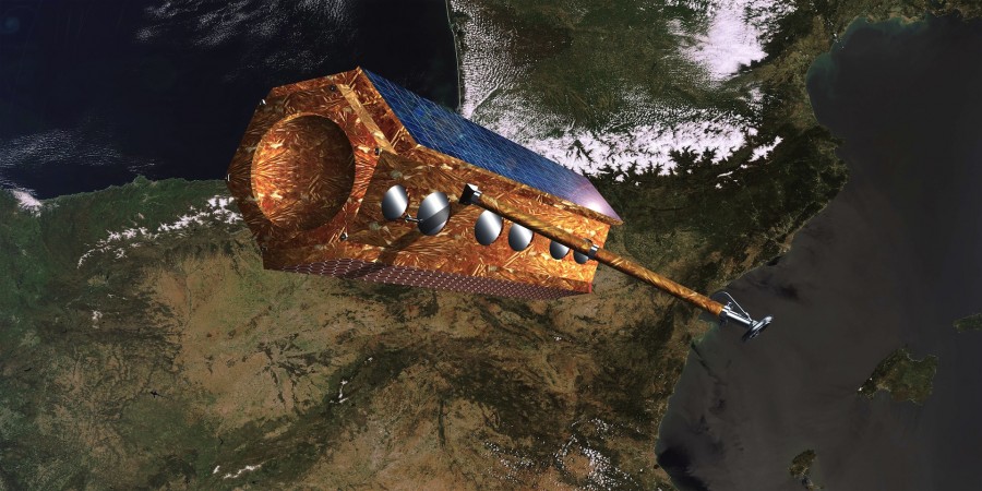
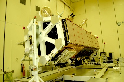
PAZ satellite and its Central Checkout System in Madrid (courtesy of Astrium CASA Espacio)
Additionally, PAZ embarks three secondary payloads that will provide useful scientific data: a polarimetric GNSS Radio-Occultation payload, a Satellite Automatic Identification System (AIS) and a Laser Retro Reflector (LRR). The former is envisaged to measure the bending of GPS signals caused by atmosphere refractivity profiles. This experiment will be a proof-of-concept to exploit the potential capabilities of polarimetric radio occultation towards detecting and quantifying heavy precipitation events. The AIS is an automatic identification and tracking system for ships and vessels. The payload on-board will be part of the exactEarth constellation, and has the objective to provide a SAR data fusion capability for maritime surveillance from space with AIS data services. The LRR experiment allows for an independent orbit determination with four corner cube prisms that reflect the laser beams back to the tracking station.
PAZ SAR antenna (courtesy of Astrium CASA Espacio)
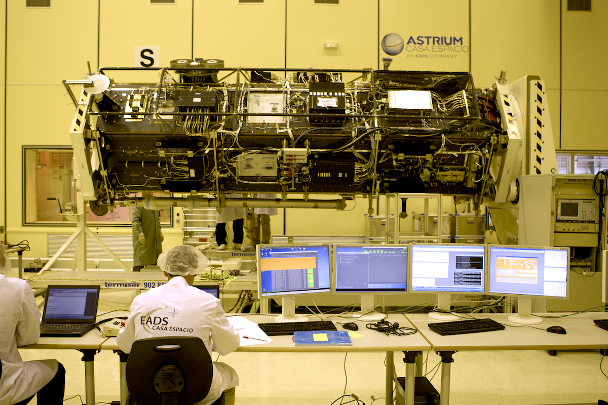
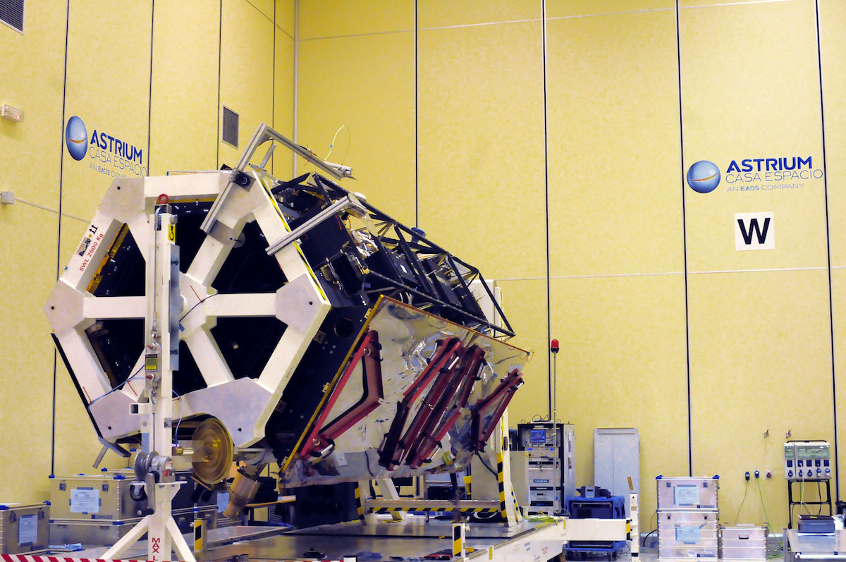
Below there is a picture of one of the very latest moments of PAZ before leaving the clean room in Astrium CASA Espacio in Madrid. A very important milestone for all the team, who excelled consistently and from whom I personally learnt a lot. The project still continues, yet after more than five years of hard work it is important to stop and think beyond; why are satellites like PAZ important to our society needs, and what else can we squeeze out of the data it will deliver? I find important to be aware of this because thinking of the benefits of what you do pushes you forward with an extra dosis of motivation. The rest is daily work.
PAZ solar panels (courtesy of Astrium CASA Espacio)
-
gnathita
-
http://albertzurita.eu/ Albert
-
-
yayo
-
http://albertzurita.eu/ Albert
-
-
http://blog.miguelangelcervera.es/ Miguel A. Cervera
-
http://albertzurita.eu/ Albert
-
http://blog.miguelangelcervera.es/ Miguel A. Cervera
-
http://albertzurita.eu/ Albert
-
-
-
-
Pedro S. Cañal
-
http://albertzurita.eu/ Albert
-