Blog
The Earth Observation BlogPyramids from Space
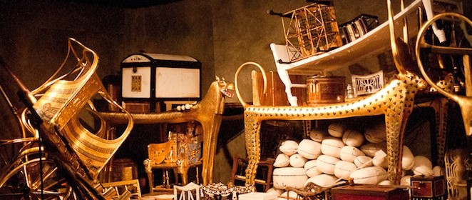
By late afternoon on November 5th 1922, the excavations at the Valley of the Kings led by Howard Carter revealed 12 stairs heading downwards into the rock. At the very end, a familiar royal seal and signs of ancient robbers. Even deeper, another sealed chamber was opened, and the hot air escaping caused the candles flames to flicker. As the eyes of Carter accustomed to the light, details of the room emerged slowly from the mist: strange animals, statues, and gold; everywhere the glint of gold. Lord Carnarvon, standing beside Carter, inquired anxiously, ‘Can you see anything?’. Carter could only get out the words ‘Yes, wonderful things’.
Archaeology is a way to learn from ourselves. How we lived into the past, how we adapted to the changing environment, what factors of our lifestyle caused destructive effects before; these are questions that archaeologists want to understand. But more important is what we can learn from our ancestors and how to apply it to our present and future societies. This is not always straightforward, since our Earth is ever changing. For instance, oceans rise, tectonic plates move, mountains erode, or deserts and glaciers change. In general, every natural disaster is affecting up to some extent the precise moment in which a particular point in human civilisation occurred. As a result, the majority of the archaeological remains nowadays are hidden from our view, either naturally buried or covered by newer settlements and cities on top.
Satellite remote sensing has the ability of seeing beyond the visible part of the electromagnetic spectrum, on a global scale and repeatedly. We can safely observe a particular landscape at different resolutions and spectral bands in such a way that ancient remains previously invisible to the naked eye may appear with great clarity. Places otherwise impossible to be observed such as waterlogged terrains, politically unstable regions, private or military areas may be studied with a non-invasive method. Not making use of the full spectrum leaves a huge amount of archaeological features or sites undiscovered. This doesn’t mean that the remains are necessarily seen with satellite data. Ancient remains will affect their surrounding landscapes in one or another way, either in soil characteristics, vegetation patterns, heat content, or moisture absorption. This subtle changes that are not visible on-ground provide hints to archaeologists, pointing to particular areas of interest that otherwise would have been randomly explored, or discovered accidentally. An example of the latter are the Catacombs of Kom el Shoqafa in Alexandria, Egypt. They were hidden for almost two millennia until 1900, when some claim that it was a donkey that hauling a cart full of stone, made a misstep and disappeared into a hole in the ground. Certainly relying on donkeys as a method of archaeological exploration doesn’t seem very efficient.
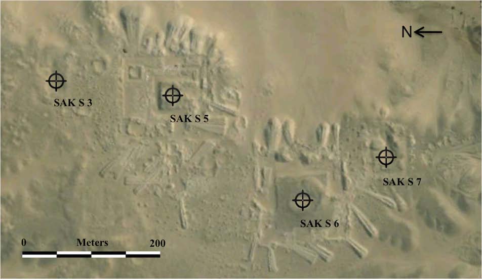
The first Egyptian site discovered with satellite remote sensing occurred in 1996, when a group of Japanese researchers found a mudbrick tomb of the New Kingdom in the Dahshur North area, Egypt. More recently in 2006, the remains of two previously unknown 13th dynasty pyramids in the South Saqqara region were discovered even when it was thought not to contain other sites. In 2008 one group at Cairo University rediscovered the pyramid of Menkauthor, found originally in 1842 but lost years later due to the desert shifting sands.

Quickbird image of the Saqqara pyramids SAK S3 and SAK S7 discovered in 2006. SAK S5 and SAK S6 were found in the 19th century (excavation ramps are seen next to the sites) (courtesy of Robert Corrie)
Of course it is impossible to know more about a potential site without ground confirmation, so the offline satellite remote sensing study is combined with surface investigations on-site and targeted excavations. This solution is quite cost-effective, since the exploration team will place trenches only in the locations in which a potential feature may be found. Nonetheless, the price to pay for some of the high-resolution imagery will be justified depending on the magnitude of the explorations and the specific needs of the team. In this sense, information about the cost, passing date, spatial resolution, coverage, and the bands acquired needs to be provided to archaeologists so that they understand the advantages and disadvantages of each image type, and the features that may be extracted from them. Once all the data are on the table, archaeologists can only really begin to appreciate a particular site once the historical and geographic contexts are examined to get a holistic reconstruction of the site. This means not only evaluating the physical remains discovered, but also understanding the regional and cultural context in which that particular site was placed in time.
Personally, I find this topic extremely interesting. And I believe that specific education in satellite remote sensing should be given to archaeologists so that they understand what can be detected and what cannot, and how to exploit the available imagery. As Sarah Parcak (one of the leaders in archaeological remote sensing) says, only 1% of the archaeological sites in Egypt have been discovered. This says it all.
-
http://www.thespacethings.com thespacethings


