Blog
The Earth Observation Blog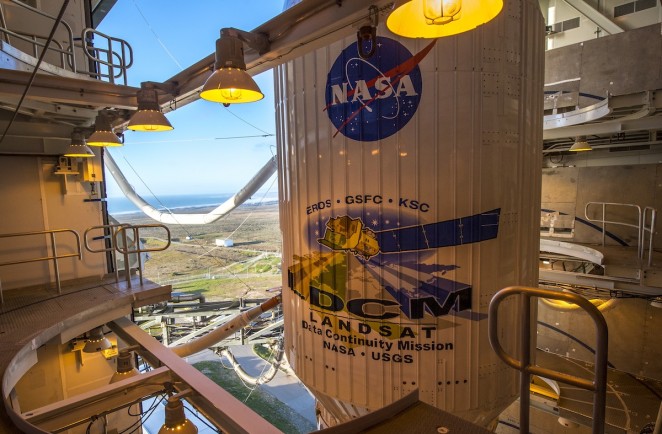
The saga continues: Landsat 8 becomes operational
Enlarging the list of successful Landsat satellites saga (save for Landsat 6), the already operational Landsat Data Continuity Mission satellite (LDCM) becomes now Landsat 8. It was at the beginning of this year that Landsat 5, which set a Guiness World Record for the longest running Earth Observation satellite (launched 1984), took its last picture of the Earth. With Landsat 6 failure at launch, Landsat 7 was the only operational satellite at the moment until now. Still, it experimented permanent problems with its Scan Line Corrector (SLC) in 2003, eliminating the satellite motion compensation operations, which results in data gaps at the edges of the images collected.
The Landsat story started in July 23 1972 with the launch of Landsat 1, known at that time as ERTS (Earth Resources Technology Satellite). It was conceived as the first Earth Observation satellite to monitor the Earth land surface at a broad-scale. At that time, scientists and engineers were not fully confident that the system would be functioning as expected, yet it proved to be a successful demonstration of the concept, and became a model for future satellite systems.

The earliest Landsat 1, 2 & 3 carried two kind of instruments on-board: the Return Beacom Vidicon (RBV) and the Multispectral Scanner Subsystem (MSS). RBV was a camera-like instrument, generating high-resolution and high geometric accuracy images of the Earth at the green, red and near infrared bands, but with low radiometric detail. After Landsat 3 (which only provided one panchromatic channel for RBV), the instrument was discontinued as attention had been given further to the MSS sensor due to RBV malfunctioning issues. MSS was conceived to provide multispectral data along the satellite across-track path through a line scanning mechanism, which covered a swath of 185 km along the west-to-east direction (known as a ‘whiskbroom’ scanner) with a spatial resolution of 79 m; the along-track strip size was 474 m. The first two satellites Landsat 1 & 2 acquired MSS data at the green, red, and 2 x near-infrared bands. However, Landsat 3 incorporated an additional far infrared band, since the RBV capabilities had been reduced.
Landsat 4 & 5 launch in 1982 and 1984, respectively, marked the final retirement of the RBV instrument and the inclusion of a new sensor called Thematic Mapper (TM). Still, the MSS was kept to ensure continuity of data to the scientific community. TM was envisaged to improve the MSS capabilities with better spatial resolution (30 m in most of the bands), finer detail with the same 185 km swath, and a scanning direction both west-to-east and east-to-west. The spectral region covered increased and was redefined with the aim of better adapting to the scientific needs, acquiring data at the blue-green, green, red, near infrared, 2 x mid-infrared and far infrared bands (7 bands in total). MSS was discontinued after Landsat 5.
The last of the operative Landsat (until now) is Landsat 7. Landsat 6 carried an upgraded version of TM called Enhanced Thematic Mapper (ETM), but the satellite was unable to reach its planned orbit during launch in 1993. Landsat 7 even improved the ETM instrument in 1999 with the Enhanced Thematic Mapper Plus (ETM+). Almost all the characteristics of TM were maintained in ETM+, except for an additional 15 m panchromatic channel, and the far infrared channel resolution improvement from 120 m in TM to 60 m (resampled later to 30 m). However, ETM+ proved to be the most accurately calibrated and stable sensor up to date.
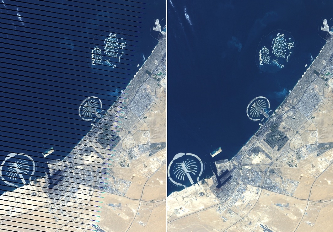
Dubai scene with SLC-off (left) and SLC-on (right) (by Hakim Abdi)
The failure of SLC in 2003 caused a systematic data loss of the 22% of every scene on average. Even that, data are of the same quality as the images collected before the SLC malfunction. At the moment a gap mask is provided with every standard product, and various gap-filling and interpolation methods are being used depending on the final application.
In this scenario and with only Landsat 7 in orbit, LCDM was launched in February 2013 embarking two brand new instruments: the Operational Land Imager (OLI) and the Thermal Infrared Sensor (TIRS). The usual spectral bands as in ETM+ were used in OLI, with an additional ultra-blue band for coastal and aerosol studies, and a mid-infrared band for cirrus clouds detection. The far infrared band in ETM+ was split into two bands in TIRS, with a resolution of 100 m (30 m after resampling). This time the sensor scanning mechanism changed from the historical whiskbroom to a pushbroom one, sampling the entire swath of 185 km at once and thus avoiding the continuous west-east movements of the mirror (in turn resulting in better sensitivity).
After NASA comissioning activities since February, May 30 2013 was the official mission handover to the US Geological Survey (USGS) and LDCM was renamed as Landsat 8. From now on, Landsat 8 will be collecting data consistent with earlier Landsat missions, allowing studies of land cover and land-use change over several years. Understanding and managing the changes in our resources such as food, water and forests becomes essential given the outstanding increase in human population and in the stress on climate.
All in all, excellent news for an excellent Earth data-stream system. Expect therefore more posts in this blog dedicated to Landsat and its applications.