Blog
The Earth Observation Blog(Modern) Art from above
Without any doubt Earth Observation has revolutionised our understanding of the Earth, and the processes that drive the major changes of our climate are just starting to be revealed to us. We’re spending our money on making people and economies healthier, safer, and better prepared to overcome the daily needs of our future societies. Forecasting and anticipating the potential alterations of climate in the following years certainly puts us in a better position to make political decisions to that respect.
But Earth Observation is also in essence the art of taking pictures from above. Photography terms such as shutter speed, focal length, aperture, noise reduction, or filters make sense somehow in the framework of satellite remote sensing; and even more specifically in optical instruments. Besides, the extraordinary point of view for shooting is definitely not within reach of every professional photographer. Astronauts on-board the International Space Station for instance have been taking pictures of the Earth; Chris Hadfield or currently Luca Parmitano. But if a large percentage of the pictures and paintings from artists we see have nature as the main subject, why not appreciating the art taken from satellites as well? I’m sure a part of the answer is simply because many people have not seen these imagery.
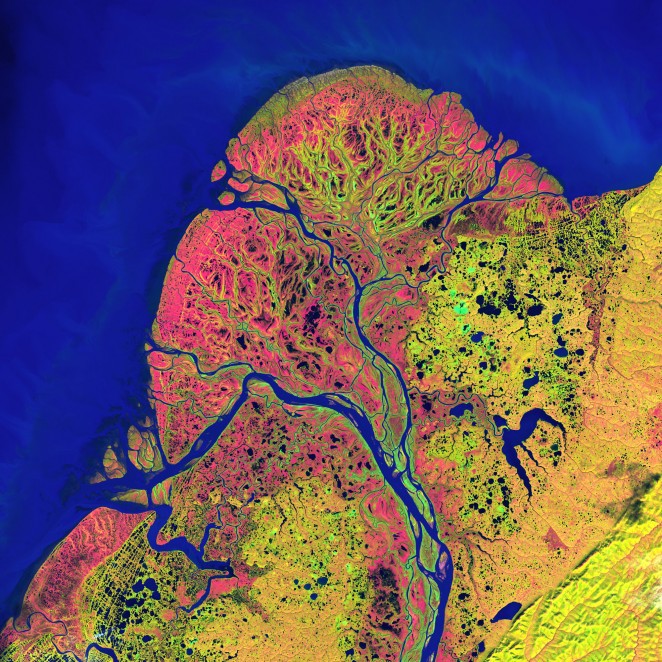
Take for instance this image acquired by Landsat 7 in September 22nd, 2001. The Yukon delta in southwest Alaska is one of the largest river deltas in the world, with its sinuous waterways resembling that of blood capillaries.
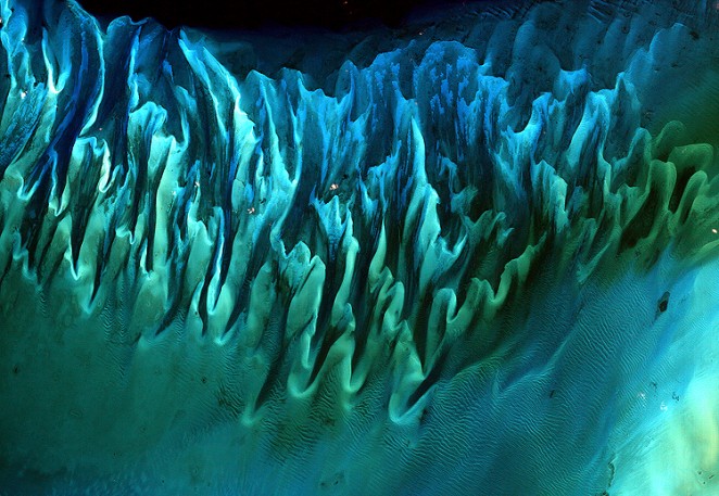
Another example is this image below taken in 2001 by Landsat 7, too, of sands and seaweed beds near the Bahamas. The tides and ocean currents sculpted them to form this multi-colored patterns.
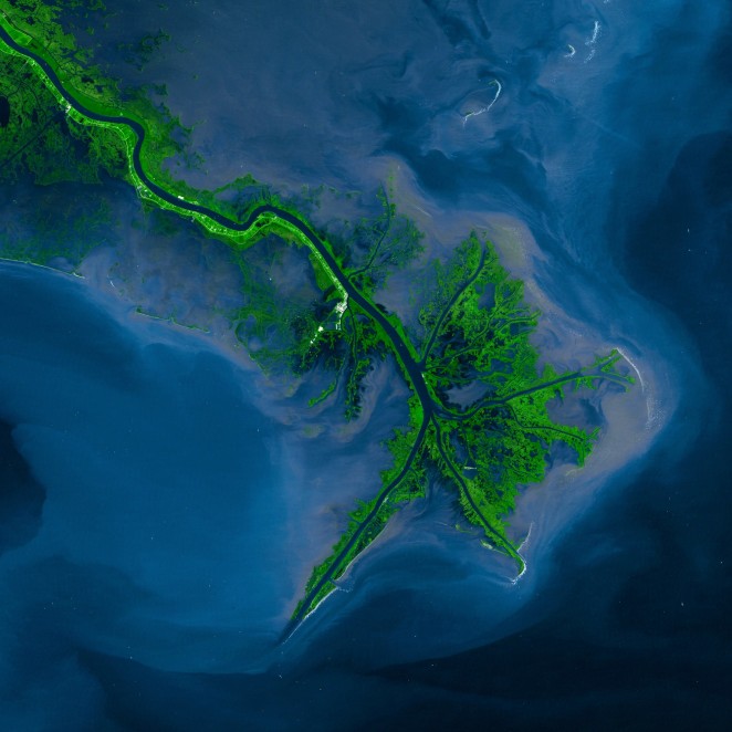
The Mississippi river delta in Louisiana ending into the Gulf of Mexico is also stunning. Again a 2001 ETM+ picture onboard Landsat 7. Healthy vegetation land surrounds the latest turns of the river, where sediments are deposited into the ocean all around the delta. It’s thought that the Mississippi changed course numerous times in the last 10,000 years roughly across 300 km along the Gulf of Mexico. The actual course is established since 600 years or so. Nonetheless, the US constructed canals and dams to prevent changes in the delta having an impact on people’s settlements.
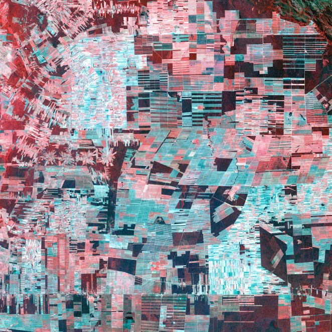
Another group of nice pics are clearly man-made, and the following picture of the Amazon basin in Bolivia is a clear example. What once was a homogeneous healthy vegetation land is now a complex sketch of geometrical patterns. Loggers and farmers have established their settlements and herds in this area of the Amazon.
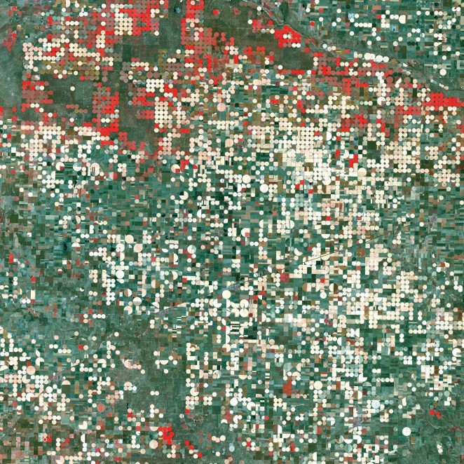
Garden City in Kansas is another example of man-made patterns in vegetation. Farmers pump the water beneath the fields out of the Ogallala Aquifer for their croplands with a circular irrigation system. Even that the aquifer naturally recharges, the amount of pumped water is larger, causing the aquifer to slowly dry. Healthy vegetation shows red in the image.
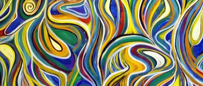
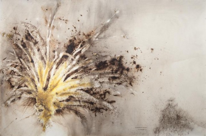
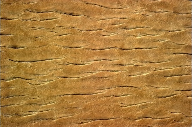
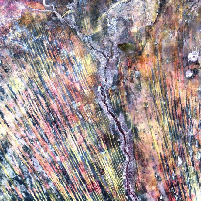
On the other side, there are naturally-made images of the Earth that may confuse us as they resemble the paintings seen for instance at MoMA (Museum of Modern Art) in New York. So I propose you try to guess whether the following five pictures are taken from space or are just pieces of contemporary art.
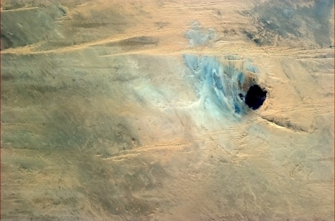
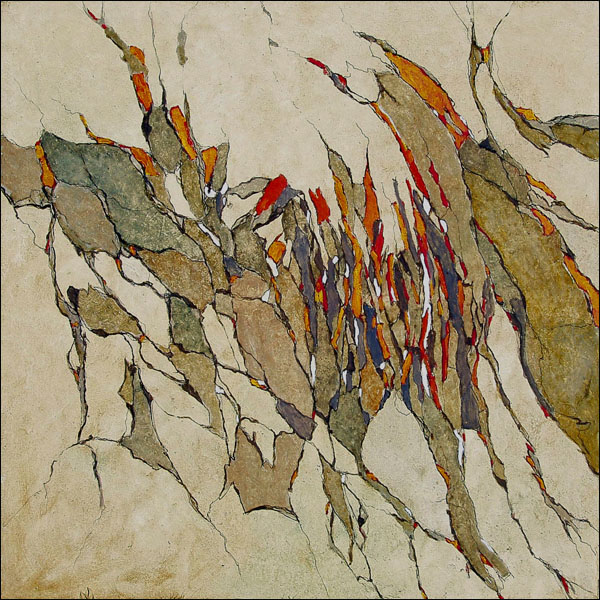
It turns out to be that pictures 1, 4 and 5 are from NASA; and 2 and 3 are modern art paintings. Picture 1 is a view of a lake in Africa, and was taken by Chris Hadfield from the ISS. Picture 2 is a painting by Jean-Pierre Vieville ‘Les futilités utiles’. Picture 3 is a painting by Cai Guo-Qiang ‘Corvocado and fantasia’. Picture 4 is a picture by Chris Hadfield of the Sahara desert. Finally, picture 4 is a Landsat 7 image of the Kalahari desert in Namibia. Curiously, a lonely farmer is still working the fields with a central irrigation system (healthy vegetation shows as a small red dot in the center of the image).
Having seen all this amazing collection of pictures, I encourage exhibition centers to organize Earth Observation shows, so that people can enjoy it, too. NASA and the ISS astronauts are doing a very good job with making space more social than ever. That’s the trend we should follow. Finally, here you are another nice time-lapse with clips taken by the ISS crew. Simply impressive…
-
Max
-
http://albertzurita.eu/ Albert
-
Ernesto
-
http://albertzurita.eu/ Albert
-


